Browsing Interface : Welcome guest : log in
|
Browsing Interface : Welcome guest : log in |
[
Home |
Graph |
LogLearn |
Editor |
]
KB:
Language:
Formal Language:
|
|
|
 SeaLevel SeaLevel
|
|
|
| appearance as argument number 1 |
|
|
| (instance SeaLevel GeographicArea) | Geography.kif 6370-6370 | Sea level is an instance of geographic area |
| (documentation SeaLevel EnglishLanguage "SeaLevel designates the global Mean Sea Surface (MSS). Note that SeaLevel represents a GeographicArea that comprises all the local Mean Sea Level (MSL) areas used as references for measuring altitude. In fact, there are local variations in MSL, due to tides and long- and short- term weather conditions.") | Geography.kif 6371-6375 | Sea level is an instance of geographic area |
| (elevation SeaLevel (MeasureFn 0.0 Meter)) |
Geography.kif 6383-6384 | 0.0 Meter(s) is an elevation of sea level |
| (externalImage SeaLevel "http://upload.wikimedia.org/wikipedia/commons/c/ c6/ Well_below_sea_level.jpg") | pictureList.kif 3188-3188 | 0.0 Meter(s) is an elevation of sea level |
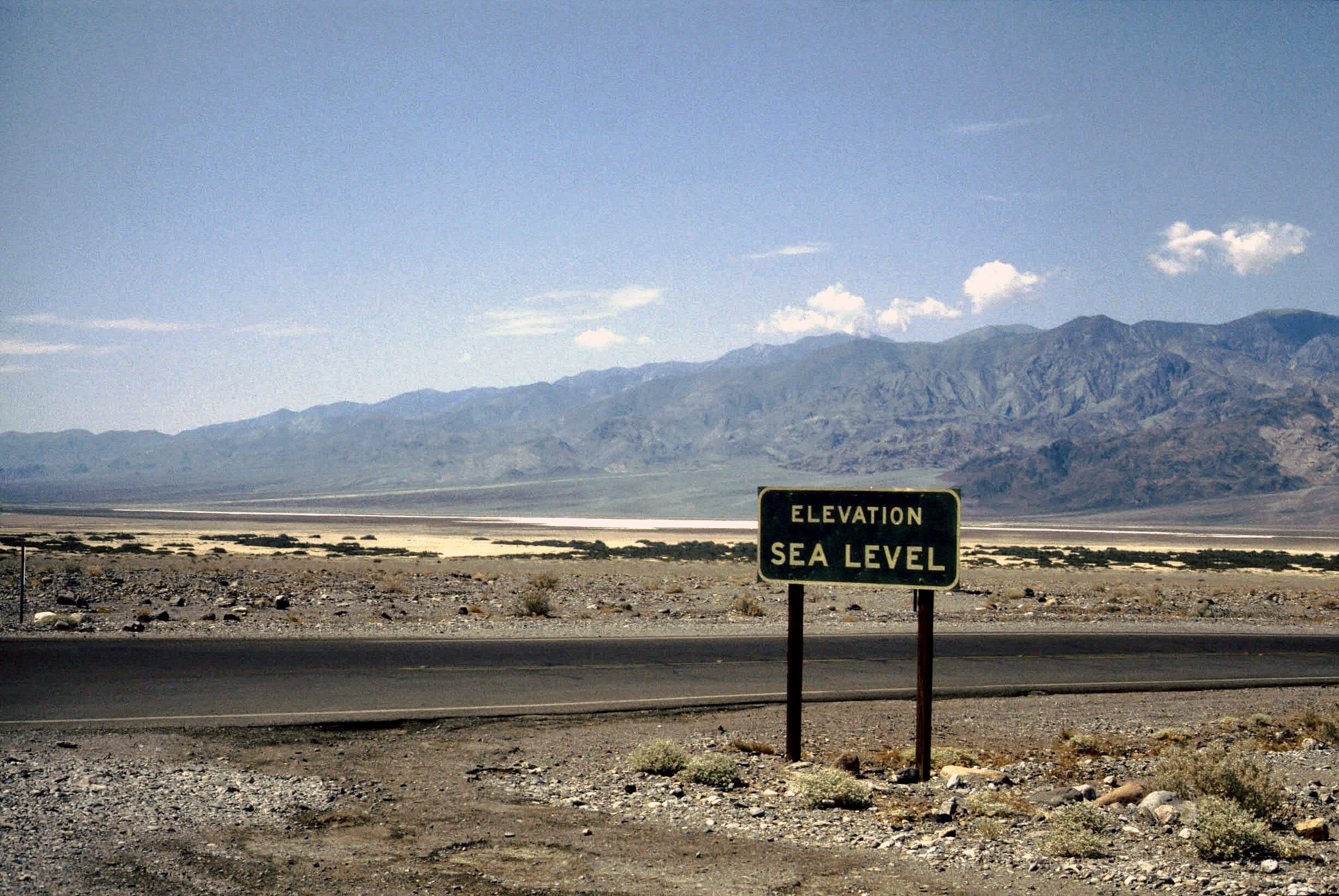
| (externalImage SeaLevel "http://upload.wikimedia.org/wikipedia/commons/c/ c8/ Death_Valley%2C19820817%2CFurnace_Creek%2Csea_level.jpg") | pictureList.kif 3189-3189 | 0.0 Meter(s) is an elevation of sea level |
| (externalImage SeaLevel "http://upload.wikimedia.org/wikipedia/commons/6/ 68/ Geosat_Sea_Level_Deviation_Winter_1987-88.gif") | pictureList.kif 3190-3190 | 0.0 Meter(s) is an elevation of sea level |
| appearance as argument number 2 |
|
|
| (distance BadwaterBasin SeaLevel (MeasureFn -86 Meter)) |
Geography.kif 530-531 | The distance between Badwater Basin and sea level is -86 meter(s) |
| (termFormat EnglishLanguage SeaLevel "sea level") | domainEnglishFormat.kif 51694-51694 | The distance between Badwater Basin and sea level is -86 meter(s) |
| (termFormat ChineseTraditionalLanguage SeaLevel "海平面") | domainEnglishFormat.kif 51695-51695 | The distance between Badwater Basin and sea level is -86 meter(s) |
| (termFormat ChineseLanguage SeaLevel "海平面") | domainEnglishFormat.kif 51696-51696 | The distance between Badwater Basin and sea level is -86 meter(s) |
| consequent |
|
|
| (=> (elevation ?OBJECT ?HEIGHT) (exists (?DATUM) (and (properPart ?DATUM SeaLevel) (orientation ?OBJECT ?DATUM Vertical) (distance ?OBJECT ?DATUM ?HEIGHT)))) |
Geography.kif 3365-3371 | If X is an elevation of Y, then there exists Z such that Z is a proper part of sea level, Y is vertical to to Z, the distance between Y, and Z is X |
| (=> (and (elevation ?OBJECT (MeasureFn ?NUM ?UNIT)) (instance ?UNIT UnitOfLength) (instance ?OBJECT LandForm)) (exists (?HIGHPOINT) (and (top ?HIGHPOINT ?OBJECT) (distance ?HIGHPOINT SeaLevel (MeasureFn ?NUM ?UNIT))))) |
Geography.kif 3373-3381 | If X Y(s) is an elevation of Z, Y is an instance of unit of length, and Z is an instance of land form, then there exists W such that the top of Z is W and the distance between W and sea level is X Y(s) |
| (=> (and (instance ?SEA Sea) (top ?TOP ?SEA)) (altitude ?TOP SeaLevel (MeasureFn 0.0 Meter))) |
Geography.kif 6307-6312 | If X is an instance of sea and the top of X is Y, then the altitude of Y relative to sea level is 0.0 meter(s) |
| (=> (and (instance ?SEA Sea) (top ?TOP ?SEA)) (altitude ?TOP SeaLevel (MeasureFn 0.0 FootLength))) |
Geography.kif 6314-6319 | If X is an instance of sea and the top of X is Y, then the altitude of Y relative to sea level is 0.0 foot length(s) |
| (=> (and (instance ?MEASURE Measuring) (patient ?MEASURE ?OBJ) (result ?MEASURE ?QUANTITY) (instrument ?MEASURE ?BAROMETER) (instance ?BAROMETER BarometricAltimeter)) (altitude ?OBJ SeaLevel ?QUANTITY)) |
MilitaryDevices.kif 1634-1641 | If X is an instance of measuring, Y is a patient of X, Z is a result of X, W is an instrument for X, and W is an instance of barometric altimeter, then the altitude of Y relative to sea level is Z |