Browsing Interface : Welcome guest : log in
Home |  Graph |  ]  KB:  Language:   

Formal Language: 


KB Term:  Term intersection
English Word: 

Sigma KEE - SeaLevel
SeaLevel

appearance as argument number 1
-------------------------


(documentation SeaLevel EnglishLanguage "SeaLevel designates the global Mean Sea Surface (MSS). Note that SeaLevel represents a GeographicArea that comprises all the local Mean Sea Level (MSL) areas used as references for measuring altitude. In fact, there are local variations in MSL, due to tides and long- and short- term weather conditions.") Geography.kif 4911-4915
(elevation SeaLevel
    (MeasureFn 0.0 Meter))
Geography.kif 4923-4924 elevation SeaLevel and 0.0 Meter(s)
(externalImage SeaLevel "http://upload.wikimedia.org/wikipedia/commons/6/ 68/ Geosat_Sea_Level_Deviation_Winter_1987-88.gif") pictureList.kif 3190-3190 elevation SeaLevel and 0.0 Meter(s)
(externalImage SeaLevel "http://upload.wikimedia.org/wikipedia/commons/c/ c6/ Well_below_sea_level.jpg") pictureList.kif 3188-3188 elevation SeaLevel and 0.0 Meter(s)
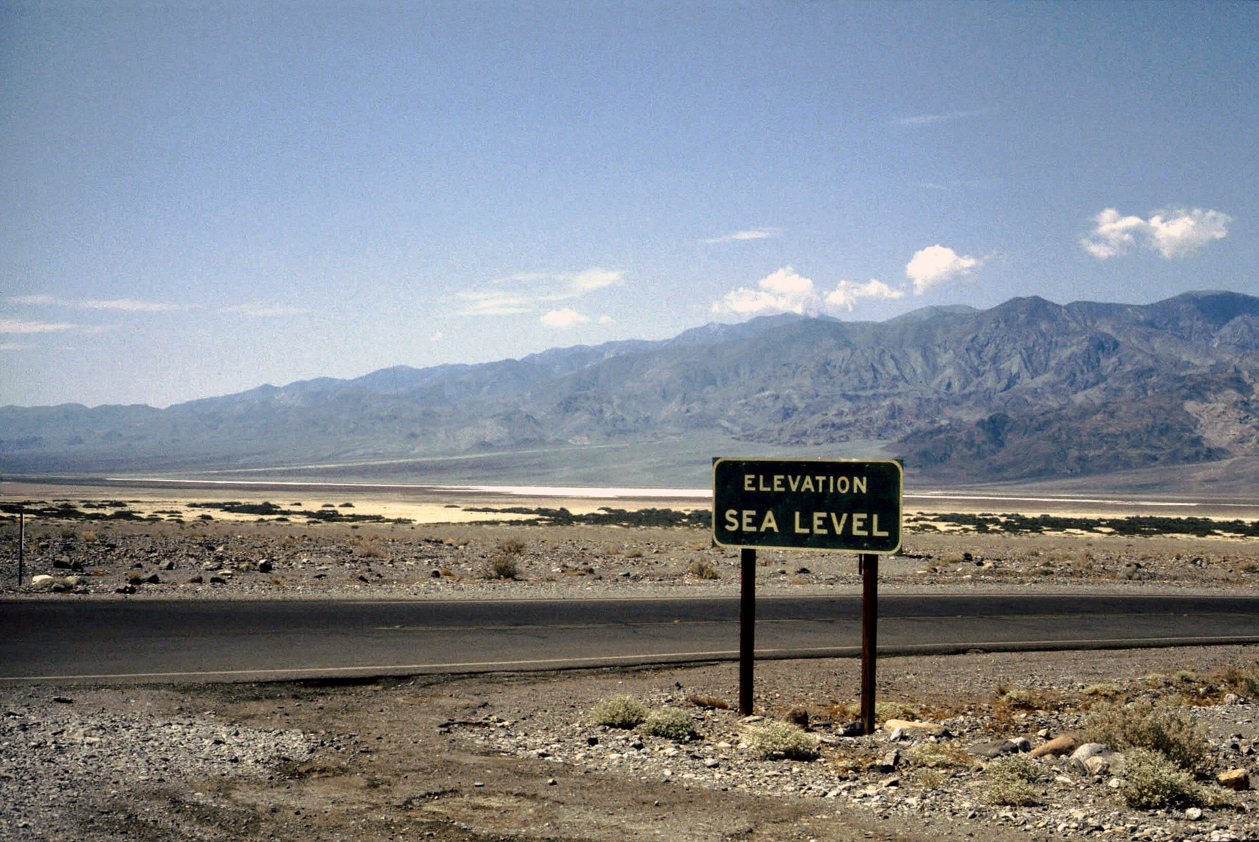
(externalImage SeaLevel "http://upload.wikimedia.org/wikipedia/commons/c/ c8/ Death_Valley%2C19820817%2CFurnace_Creek%2Csea_level.jpg") pictureList.kif 3189-3189 elevation SeaLevel and 0.0 Meter(s)
(instance SeaLevel GeographicArea) Geography.kif 4910-4910 SeaLevel est une instance de secteur g�ographique

appearance as argument number 2
-------------------------


(termFormat ChineseLanguage SeaLevel "海平面") domainEnglishFormat.kif 51703-51703
(termFormat ChineseTraditionalLanguage SeaLevel "海平面") domainEnglishFormat.kif 51702-51702
(termFormat EnglishLanguage SeaLevel "sea level") domainEnglishFormat.kif 51701-51701

consequent
-------------------------


(=>
    (and
        (elevation ?OBJECT
            (MeasureFn ?NUM ?UNIT))
        (instance ?UNIT UnitOfLength)
        (instance ?OBJECT LandForm))
    (exists (?HIGHPOINT)
        (and
            (top ?HIGHPOINT ?OBJECT)
            (distance ?HIGHPOINT SeaLevel
                (MeasureFn ?NUM ?UNIT)))))
Geography.kif 1910-1918
(=>
    (and
        (instance ?MEASURE Measuring)
        (patient ?MEASURE ?OBJ)
        (result ?MEASURE ?QUANTITY)
        (instrument ?MEASURE ?BAROMETER)
        (instance ?BAROMETER BarometricAltimeter))
    (altitude ?OBJ SeaLevel ?QUANTITY))
MilitaryDevices.kif 1634-1641
(=>
    (and
        (instance ?SEA Sea)
        (top ?TOP ?SEA))
    (altitude ?TOP SeaLevel
        (MeasureFn 0.0 FootLength)))
Geography.kif 4842-4847
(=>
    (and
        (instance ?SEA Sea)
        (top ?TOP ?SEA))
    (altitude ?TOP SeaLevel
        (MeasureFn 0.0 Meter)))
Geography.kif 4835-4840
(=>
    (elevation ?OBJECT ?HEIGHT)
    (exists (?DATUM)
        (and
            (properPart ?DATUM SeaLevel)
            (orientation ?OBJECT ?DATUM Vertical)
            (distance ?OBJECT ?DATUM ?HEIGHT))))
Geography.kif 1902-1908


Show full definition with tree view
Show simplified definition (without tree view)
Show simplified definition (with tree view)


Sigma web home      Suggested Upper Merged Ontology (SUMO) web home
Sigma version 3.0 is open source software produced by Articulate Software and its partners